Posted on

Sailing poster July 2022 edition

Glad to present a new small but not so small update on the “All the Sailing on a Single Map” poster infographic. Every small update need recomposite lots of elements of the illustration, and it takes time.

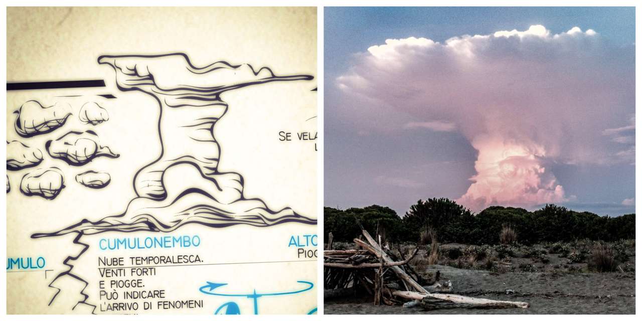
Weather section redesigned: wind strength now also shows visually its scale with the windsock rings. Each ring indicates the wind velocity of 5 knots: So in this way 5 fully blown rings correspond approximately to a wind speed of 25 knots. Height of waves, maneuvers, navigation speed in knoths are interconnected and more readable in a linear scheme from left to right.

Continue reading Sailing poster July 2022 edition
Posted on

Sailing poster ancestor

I found out something interesting today, and fascinating. Something which witnessed the fact that time pass but design universals returns.

I was contacted by a map collector, hunting for a treasure. He showed me a digital scan of an old lythography poster, from 1850, a map very similar to my work: “LWAP All the sailing in a single map”. It made me jump on the chair: it really looked like someone almost made the same artwork centuries ago.

Continue reading Sailing poster ancestor
Posted on

Monkey fist, sails and all the knots on a single rope

The monkey fist has always been my favorite knot. One of the most difficult to achieve: I spent a whole summer in the 90’s to accomplish a sufficient one. With a ball of paper in the center, or better, a lead ball.

Because the monkey fist, a perfect sphere made of tighten rope necks, resembling strong thin fingers, was a useful knot: used as a throwing weight, on the docks for mooring lines.

Continue reading Monkey fist, sails and all the knots on a single rope
Posted on

Layline, tallship sails, restyling

cumulonembo illustration photo

The August 2018 version of the “all the sail in a single map” poster is ready.

The day when I was drawing the illustrations in the weather section, and the cumulonimbus specifically, it happened the same evening that I met a real one, as it could have taken out exactly from my infographic map.

Shortly thereafter, a storm of lightning and raining happened just as the weather visual forecasts promises. The menacing mushroom-shaped column of the cumulonimbus leaves no hope: nearby lightning and extreme weather are probable, just as written on the map.

Continue reading Layline, tallship sails, restyling

Posted on

“All about sailing” poster infographic update

Update 28/08/2016, ver. 1.36

Added some nautical terms and minor fixes on the english version. I removed the previous generic oar boat and drew dinghy boat with a mast. Islands directions are bigger and added to the legenda as “local informations”. And most important, the illustrations now covers over the margins. On the left the new Dinghy illustration included in the poster.

Main article post about this work

“All about sailing in a Map” is available on Learn with a Poster store.

{loadmodule mod_custom,Learn with a Poster}